
If this hasn’t happened to you, it’s happened to me: I’m headed to an unfamiliar place in a city for the first time, and I plug in the address into my GPS. So far, so good. Let’s say it’s an address in a dense city like New York City, something like 1211 6th Avenue. You head on over.
You get close, and the friendly GPS voice says “you have reached your destination”. But you’re like “really?!?”. You get all stressed out as you see something like this:
How are you supposed to know which building it’s in? Where do you park? You spend the next 15 minutes in a nasty mood as you park somewhere close and then walk around for a few minutes figuring out where to go. What a PITA.
So how do you make life easier on yourself? With Google Street View, from Google Maps!
What Is Google Street View?
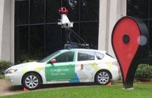
It’s a project whereby Google decided to take 3-D pictures of the streets of entire cities all around the world, using cars like this:
In my experience, it has photographed essentially every place in the United States, as well as many major cities worldwide, including wonderful places like Paris.
How to Use Google Street View
The next time you’re going to a new place in a big city, save yourself that headache and look at it on Google Street View, so you know what it’ll look like when you get there, and you know what to expect. So let’s say I’m going to have an overnight stay at the Hilton Garden Inn Times Square in NYC. Here’s what to do (on a desktop or laptop computer):
1. Open the website for Google Maps.
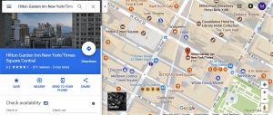
2. Search for the name of the place or address:
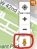
3. Look for a little yellow man on the lower right corner of your screen:
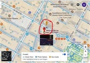
4. Click and drag the little yellow man onto the street (not the building) right in from of the place you’re headed to:
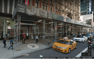
5. Release the mouse button to drop him into the street. Viola! You should see something like this:
6. You are now taking a virtual tour of your location. You can click and drag to move around until you find the place you’re looking for. Notice such place, as well as the date the picture was taken (on the bottom right corner):
7. Unless the picture is outdated, now you’ll have a much better idea of what you’ll find when you get there. Makes life easier for me.
Bonus Purposes
You can use street view and/or Google Maps for many things, depending on how creative (or mischievous) you’re feeling. For example:
- Virtual tourism
- Finding somebody’s house
- Finding out whether someone’s business address is real
Bottom Line
Street View is an incredibly useful tool to help you in pre-planning a trip to an unfamiliar location. You can also get creative with it and give it lots of other uses. I hope it makes your life easier!
10/1/2017 Update:
As asked by GenY Money, here’s how to access street view within the Google Maps app:
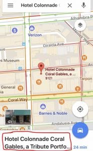
1. Open it and look up a place, and then tap the place name at the bottom:
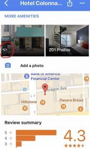
2. You should get a screen that looks like this:
3. Scroll down until you see a picture with a circular icon on it, and then tap on the picture:
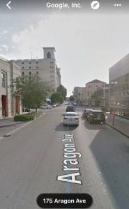
4. And there you have Google Street View:




I love using street view! i should check to see if there’s Google Streetview on the Google Maps app!
Hi GYM, thanks for asking about the app. I’ve now updated the post with instructions on how to access Street View on the app. 🙂